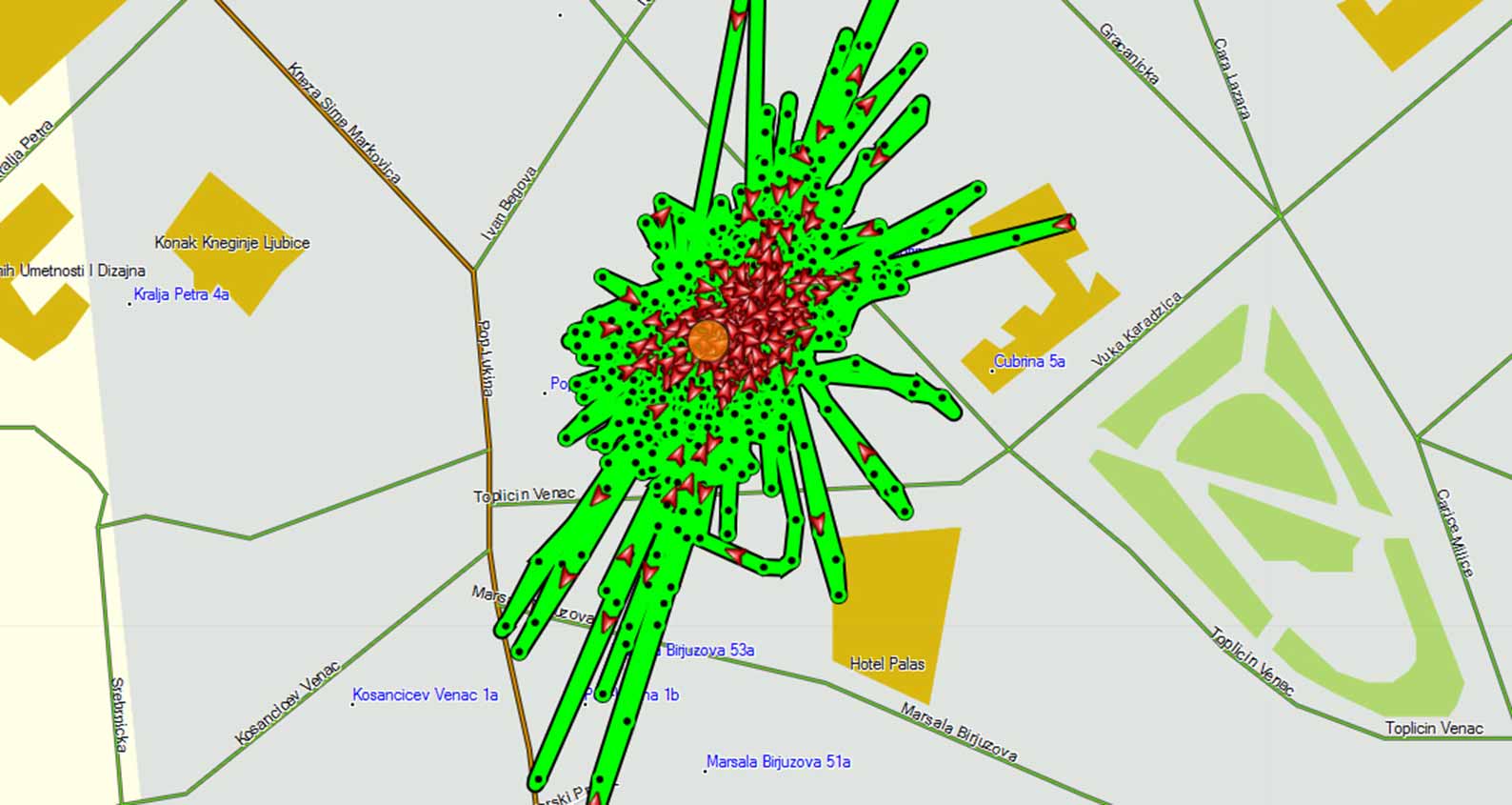
I made this work within the Rhizome of the City workshop/exhibition initiative that employed GPS and the Internet to represent the participants’ cognitive mapping in their environments.
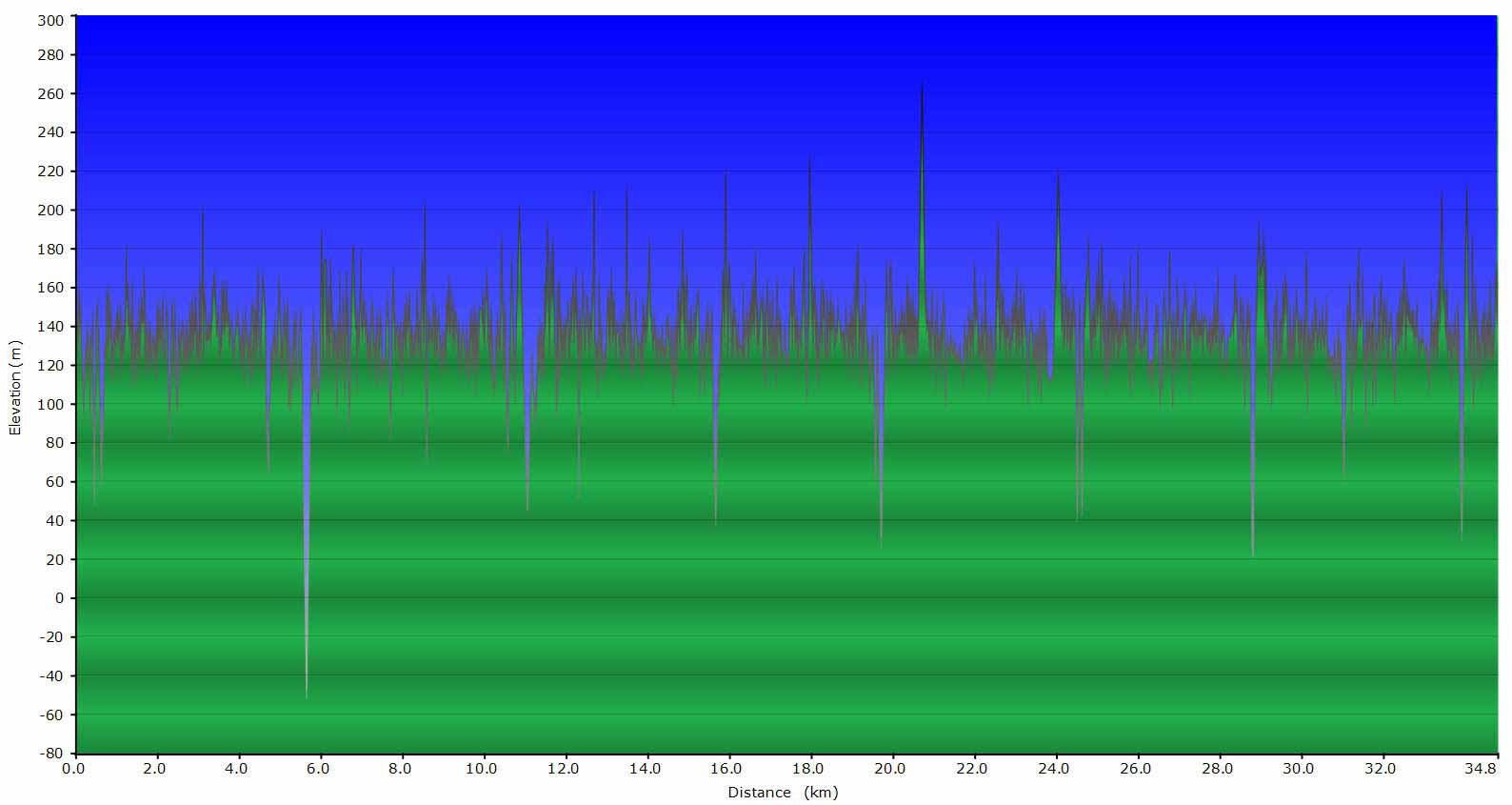
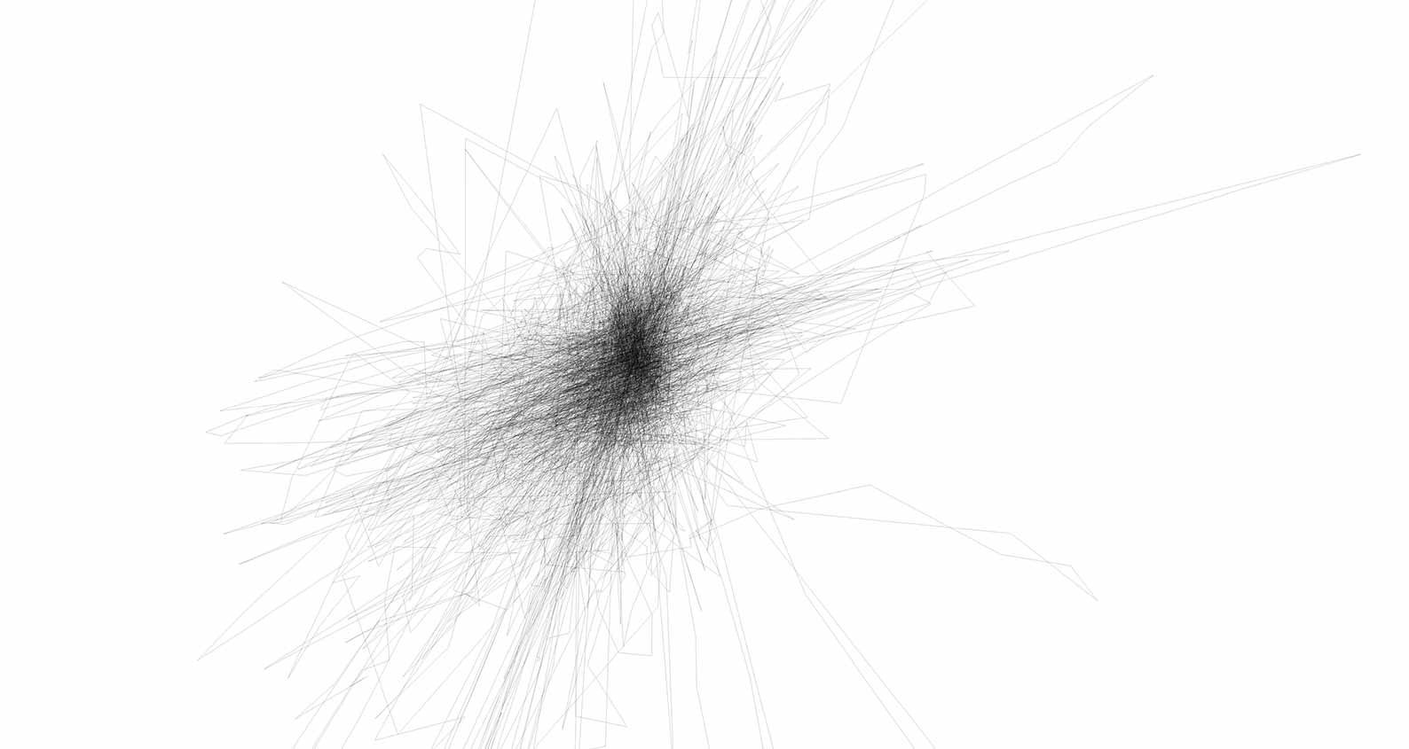
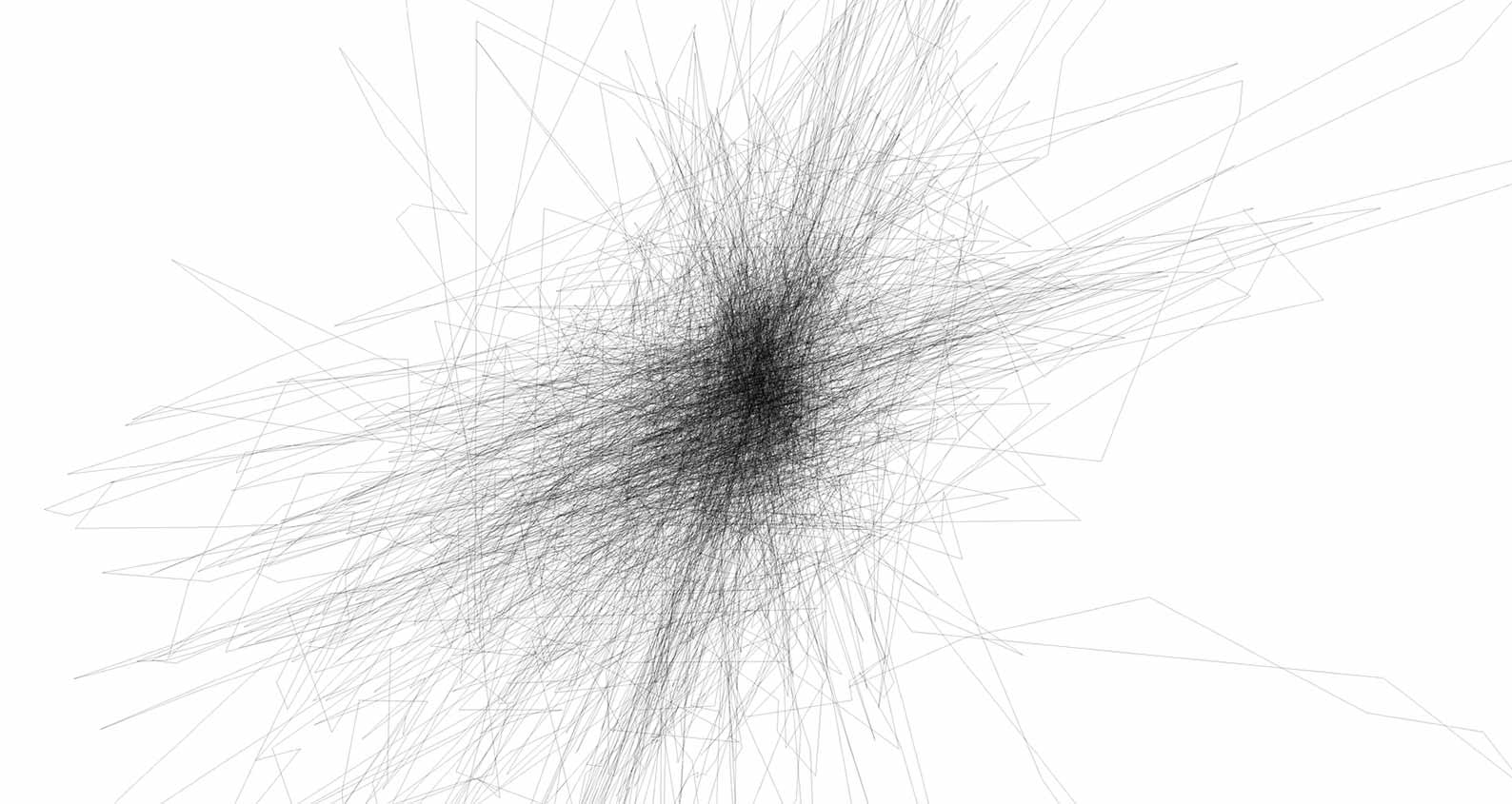
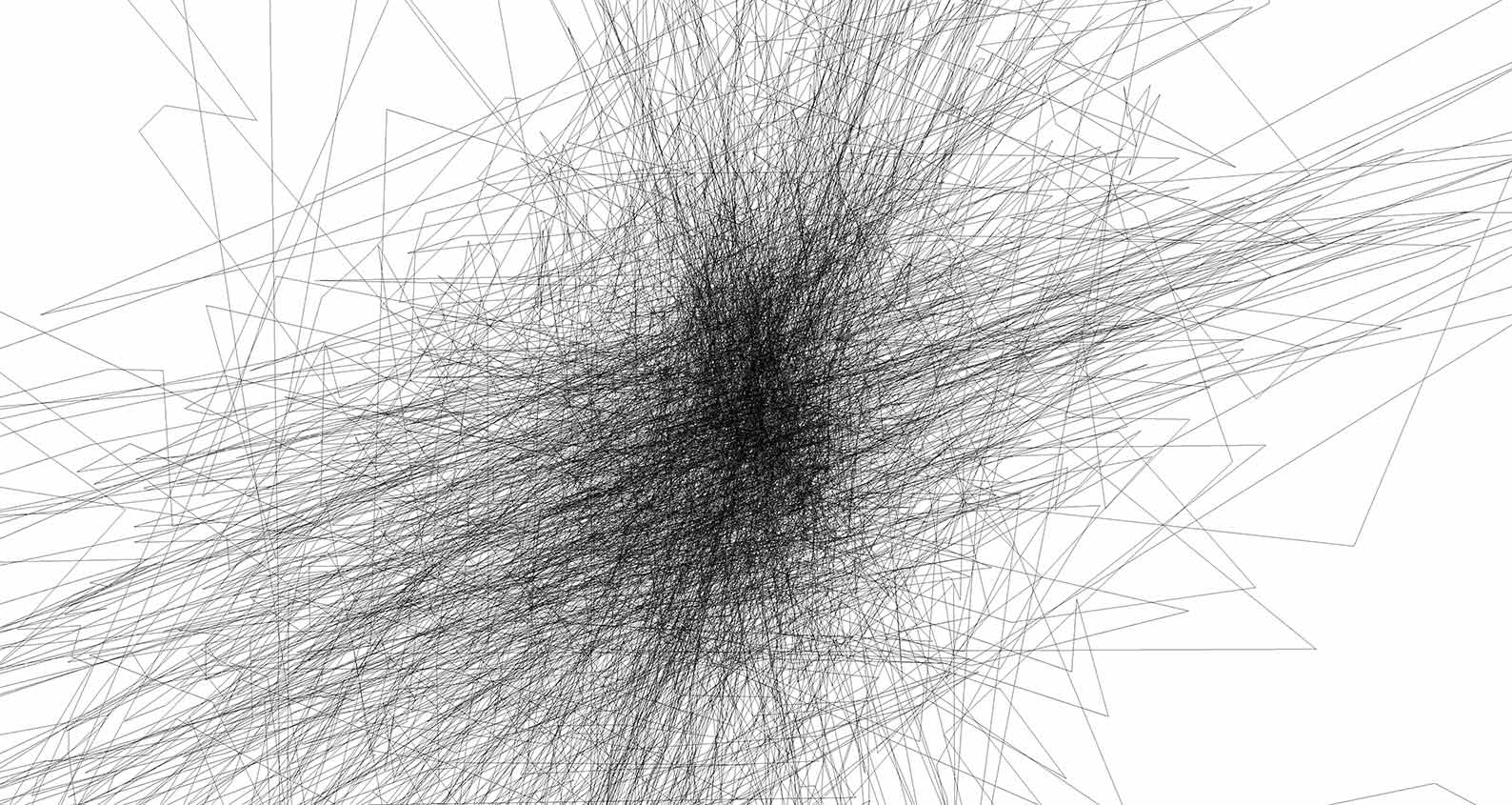
Cognitive mapping is an individual, non-linear and discontinual experience of space and spatial relations. My urban strategy in Belgrade prefers mediated (electronic) to physical transactions, and I visualized it as a composite GPS drawing that had registered my immobility and my web browsing from 7 July 2010 in 16:46:36 to 15 July 2010 in 00:02:47. During that time the GPS receiver was on my studio table but, due to GPS inaccuracy, it recorded 8438 points on a path 34.8km long. This path is a generative study of the variance or deviation from the ideal model, which determines both the technology and the creative process.
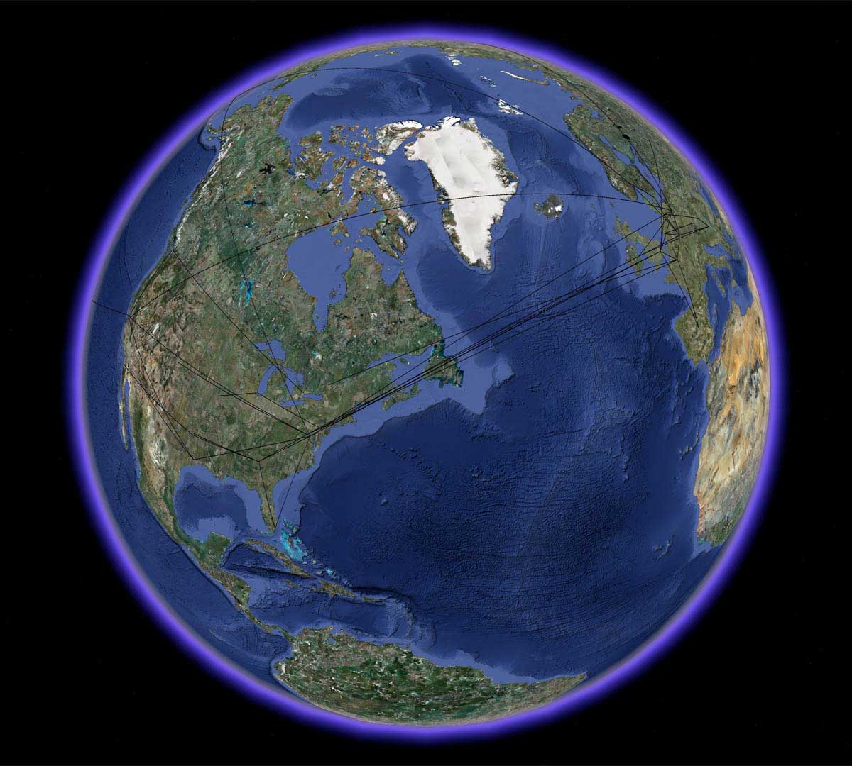
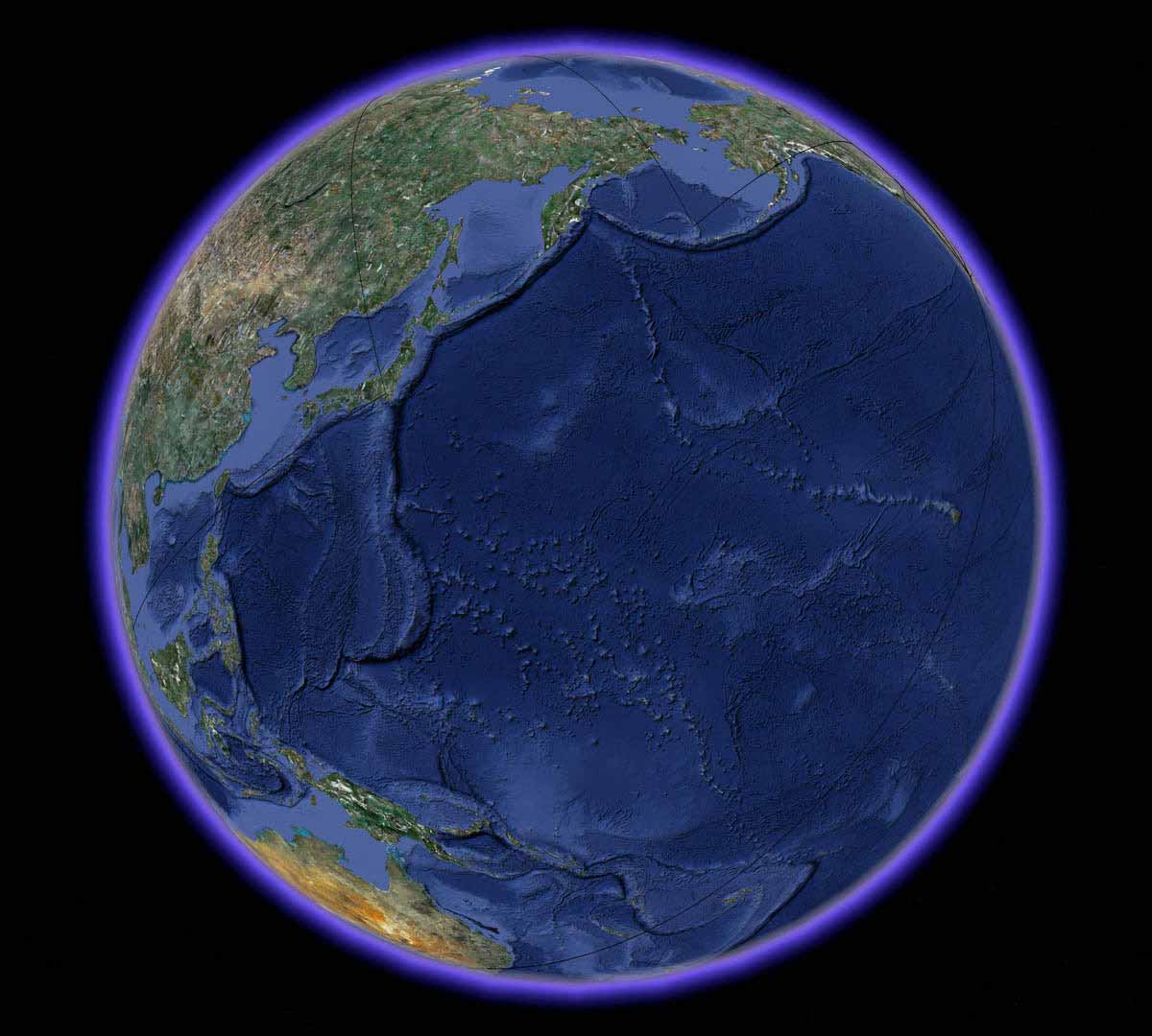
I made the web browsing geopaths by selecting 18 web pages I opened in that period, and by finding and connecting the geographic coordinates of the servers (IP addresses) that provided the packet transfer for each web page. As the Internet is a distributed network with a number of connecting scenarios, these geopaths are also time-specific.
Study combines the static GPS path with all the Internet geopaths which are also visualized in a flyover mode. It can be viewed interactively by downloading a KMZ file and opening it in Google Earth in Chrome browser, or in a desktop Google Earth application.
Main path details: GPS device Garmin GPSmap 60Cx | Trip duration 7 days 7 hours 16 minutes 11 seconds | Points 8438 | Track length 34.8km | Area 2.104km2 | Average speed 0.2km/h | Maximum speed 17.9km/h.
Some of the projects of the Internet traffic geotracing: Visualizing the Global Topology of the MBone, 1996; Ride the Byte, 1999 (ART+COM); An Atlas of Cyberspace, 1997-2004 (Martin Dodge and Rob Kitchin), and Mapping the Internet, 2008 (Matthew Zook).
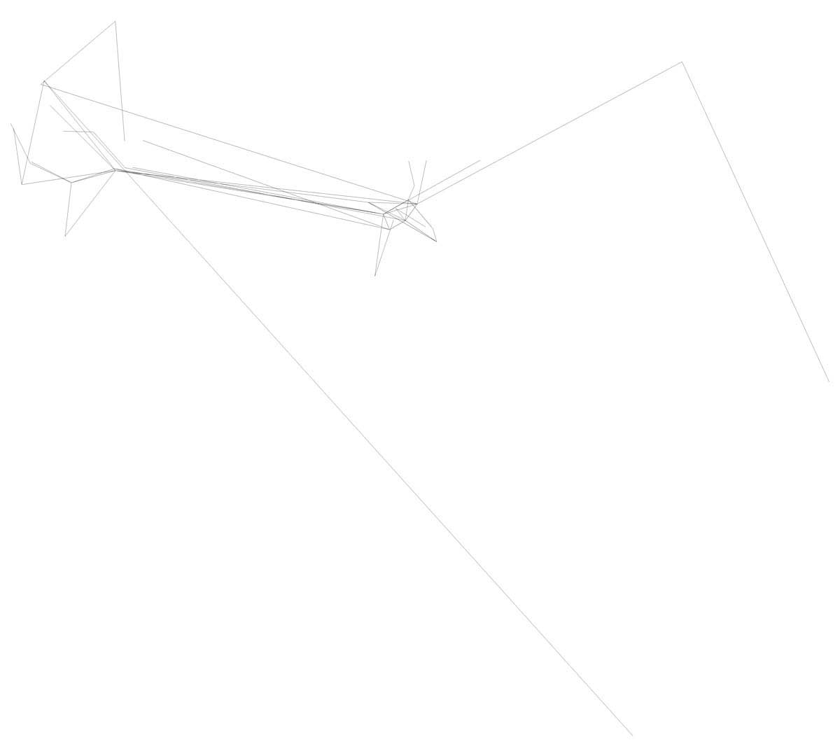
Geopath details for Wikipedia on 15 July 2010 at 17:05:22: Belgrade: IP 192.168.1.145; lat=44.8168850752771; lon=20.453640818595886 | Dublin: IP 77.67.75.201; lat=53.34399288223421; lon=-6.273193359375 | Berlin: IP 89.149.183.238; lat=52.52060806001903; lon=13.39731216430664 | Washington D.C.: IP 207.88.13.62; lat=38.899583425982705; lon=-77.0306396484375 | Atlanta: IP 207.88.12.9; lat=33.770015152780125; lon=-84.38873291015625 | Miami: IP 207.88.12.6; lat=25.78381688178459; lon=-80.2056884765625 | Washington D.C.: IP 207.88.13.62; lat=38.899583425982705; lon=-77.0306396484375 | San Francisco: IP 208.80.152.2; lat=37.77831314799669; lon=-122.4209976196289.
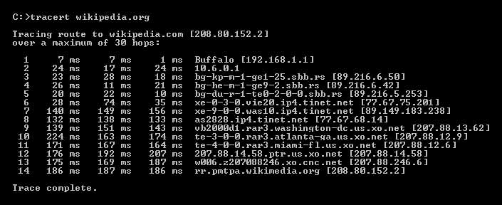
Traceroute for Wikipedia.
Study belongs to a series that explores the possibility of a research-based metodology for the creation of complex projects whose overall effects surpass the conventional understanding of the study primarily as an aid for clarifying, developing and perfecting the conceptual, technical and formal elements of the final artwork. Other works in the series are Dog Life Days (1997), All My People Right Here Right Now (2002), Scream Mirror (2003), a (2006), Alibi (Black or White) (2012) and Anticipations (2015).
An important reference is a pioneering GPS project by Laura Kurgan You Are Here: Museu MACBA, Barcelona from 1995.
Selected bibliography on Internet mapping: Dodge, Martin, and Rob Kitchin. Mapping Cyberspace. New York: Routledge, 2001; Dodge, Martin, and Rob Kitchin. The Atlas of Cyberspace. Harlow, UK: Pearson Education, 2001.
I animated the main path dataset from Study in Study 7/0 (2018).
Study was presented at the New Technologies 2010 exhibition in Gallery of Contemporary Art, Cultural Center of Pančevo in 2010, and at Rhizome of the City exhibition in the Museum of Science and Technology, Belgrade in 2010.
Bibliography: Dejan Grba, I Know What I Drew Last Summer, 2010.